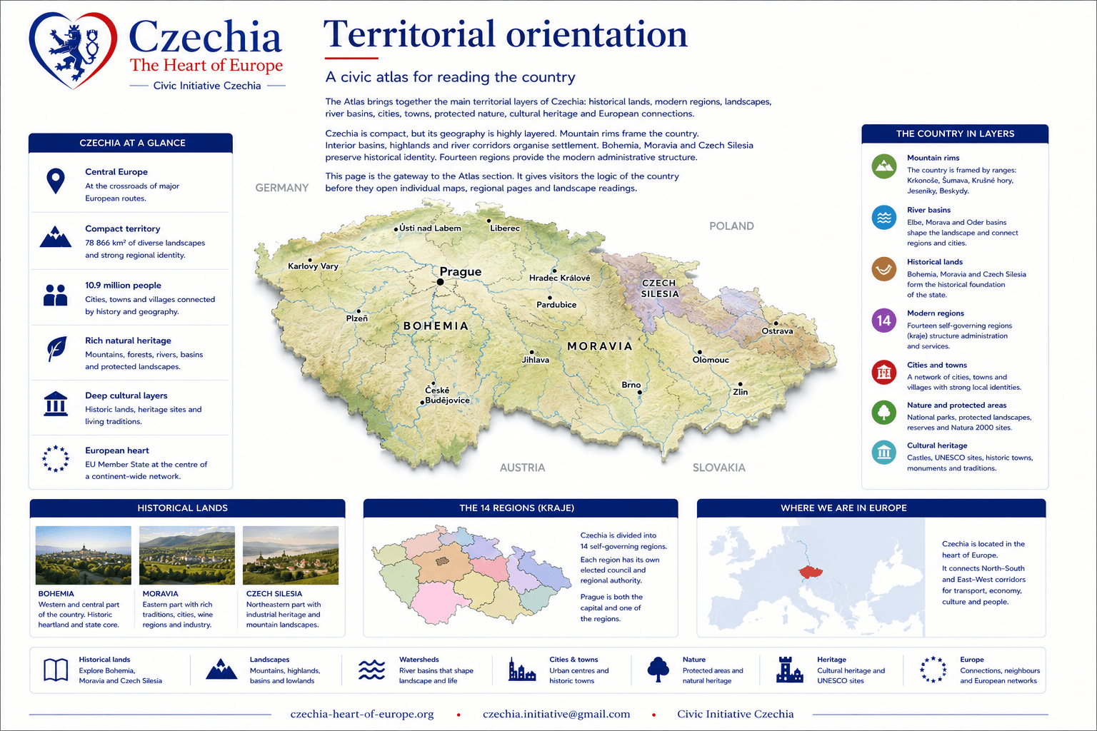
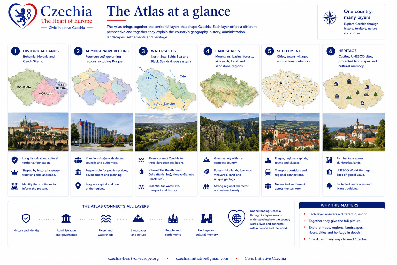
The Atlas brings together the main territorial layers of Czechia: historical lands, modern regions, landscapes, river basins, cities, towns, protected nature, cultural heritage and European connections.
Czechia is compact, but its geography is highly layered. Mountain rims frame the country. Interior basins, highlands and river corridors organise settlement. Bohemia, Moravia and Czech Silesia preserve historical identity. Fourteen regions provide the modern administrative structure.
This page is the gateway to the Atlas section. It gives visitors the logic of the country before they open individual maps, regional pages and landscape readings.
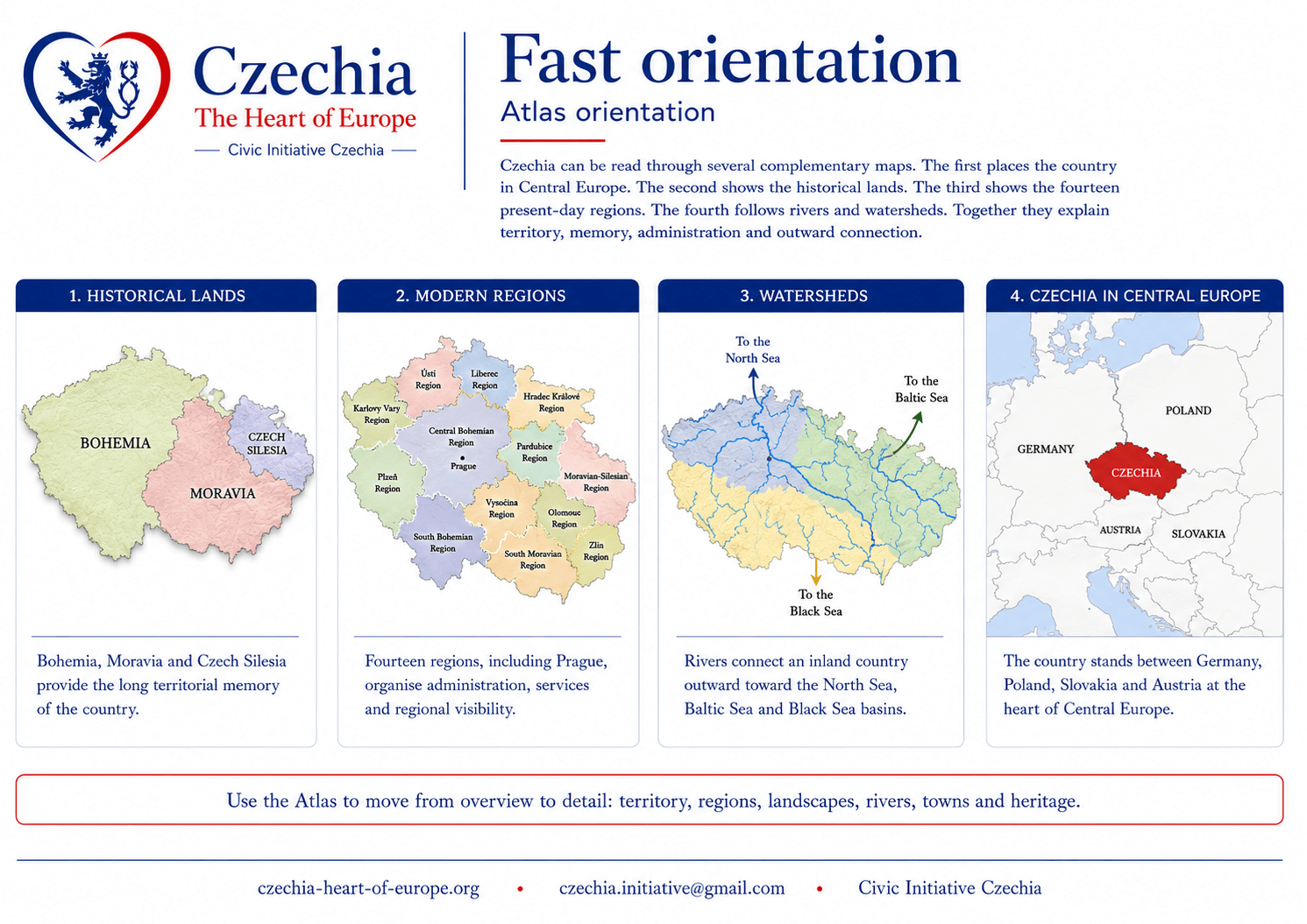
Czechia can be read through several complementary maps. The first places the country in Central Europe. The second shows the historical lands. The third shows the fourteen present-day regions. The fourth follows rivers and watersheds. Together they explain territory, memory, administration and outward connection.
Historical landsBohemia, Moravia and Czech Silesia provide the long territorial memory of the country.
Modern regionsFourteen regions, including Prague, organise administration, services and regional visibility.
WatershedsRivers connect an inland country outward toward the North Sea, Baltic Sea and Black Sea basins.
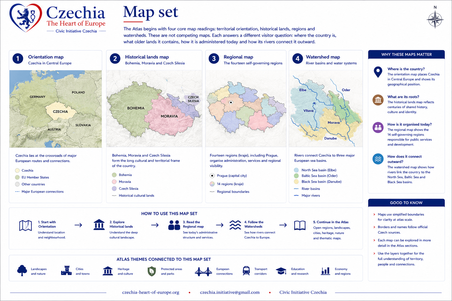
The Atlas begins with four core map readings: territorial orientation, historical lands, regions and watersheds. These are not competing maps. Each answers a different visitor question: where the country is, what older lands it contains, how it is administered today and how its rivers connect it outward.
Orientation mapCzechia in Central Europe, surrounded by Germany, Poland, Slovakia and Austria.
Historical lands mapBohemia, Moravia and Czech Silesia as the long cultural and territorial frame.
Regional mapThe fourteen self-governing regions used in contemporary public administration.
Watershed mapRiver basins and water systems connecting the country to European seas.
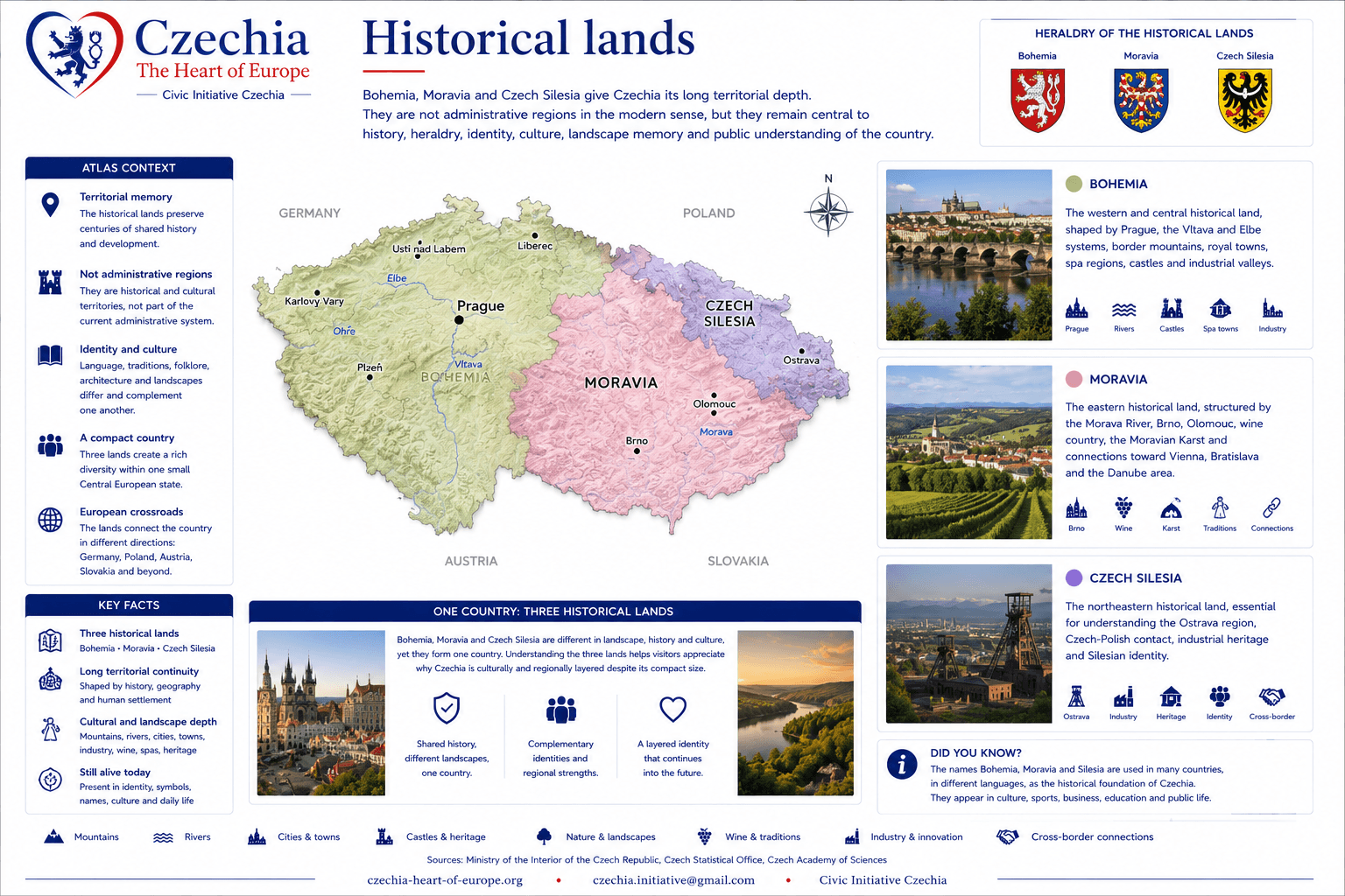
Bohemia, Moravia and Czech Silesia give Czechia its long territorial depth. They are not administrative regions in the modern sense, but they remain central to history, heraldry, identity, culture, landscape memory and public understanding of the country.
BohemiaThe western and central historical land, shaped by Prague, the Vltava and Elbe systems, border mountains, royal towns, spa regions, castles and industrial valleys.
MoraviaThe eastern historical land, structured by the Morava River, Brno, Olomouc, wine country, the Moravian Karst and connections toward Vienna, Bratislava and the Danube area.
Czech SilesiaThe northeastern historical land, essential for understanding the Ostrava region, Czech-Polish contact, industrial heritage and Silesian identity.
One countryThe three historical lands help visitors understand why Czechia is culturally and regionally layered despite its compact size.
Czechia has fourteen regions, including Prague. Regions matter for public administration, transport, education, healthcare, tourism, investment, culture, emergency planning and regional identity. They are the most practical territorial layer for contemporary orientation.
The regions belong beside the historical lands, not against them. Historical lands explain long-term memory. Regions explain current public organisation and everyday territorial navigation.
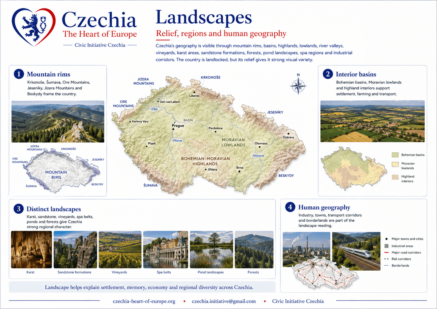
Czechia’s geography is visible through mountain rims, basins, highlands, lowlands, river valleys, vineyards, karst areas, sandstone formations, forests, pond landscapes, spa regions and industrial corridors. The country is landlocked, but its relief gives it strong visual variety.
Mountain rimsKrkonoše, Šumava, Ore Mountains, Jeseníky, Jizera Mountains and Beskydy frame the country.
Interior basinsBohemian basins, Moravian lowlands and highland interiors support settlement, farming and transport.
Distinct landscapesKarst, sandstone, vineyards, spa belts, ponds and forests give Czechia strong regional character.
Human geographyIndustry, towns, transport corridors and borderlands are part of the landscape reading.
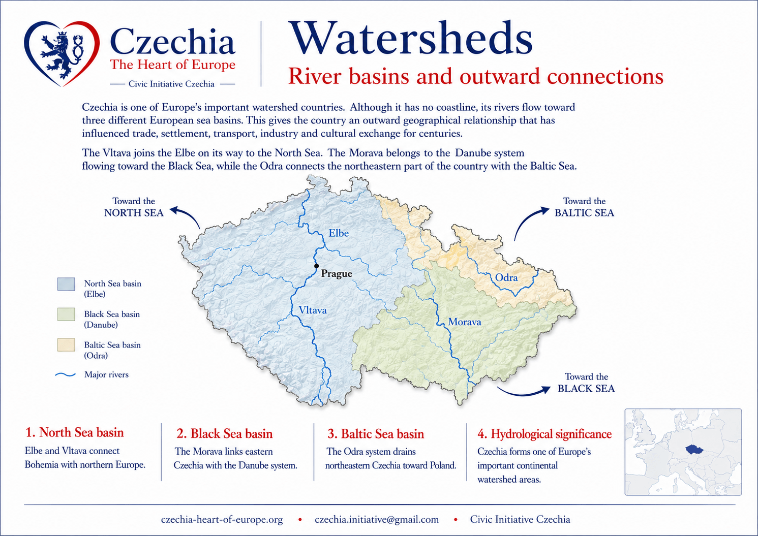
Czechia is one of Europe's important watershed countries. Although it has no coastline, its rivers flow toward three different European sea basins. This gives the country an outward geographical relationship that has influenced trade, settlement, transport, industry and cultural exchange for centuries.
The Vltava joins the Elbe on its way to the North Sea. The Morava belongs to the Danube system flowing toward the Black Sea, while the Odra connects the northeastern part of the country with the Baltic Sea.
North Sea basinElbe and Vltava connect Bohemia with northern Europe.
Black Sea basinThe Morava links eastern Czechia with the Danube system.
Baltic Sea basinThe Odra system drains northeastern Czechia toward Poland.
Hydrological significanceCzechia forms one of Europe's important continental watershed areas.
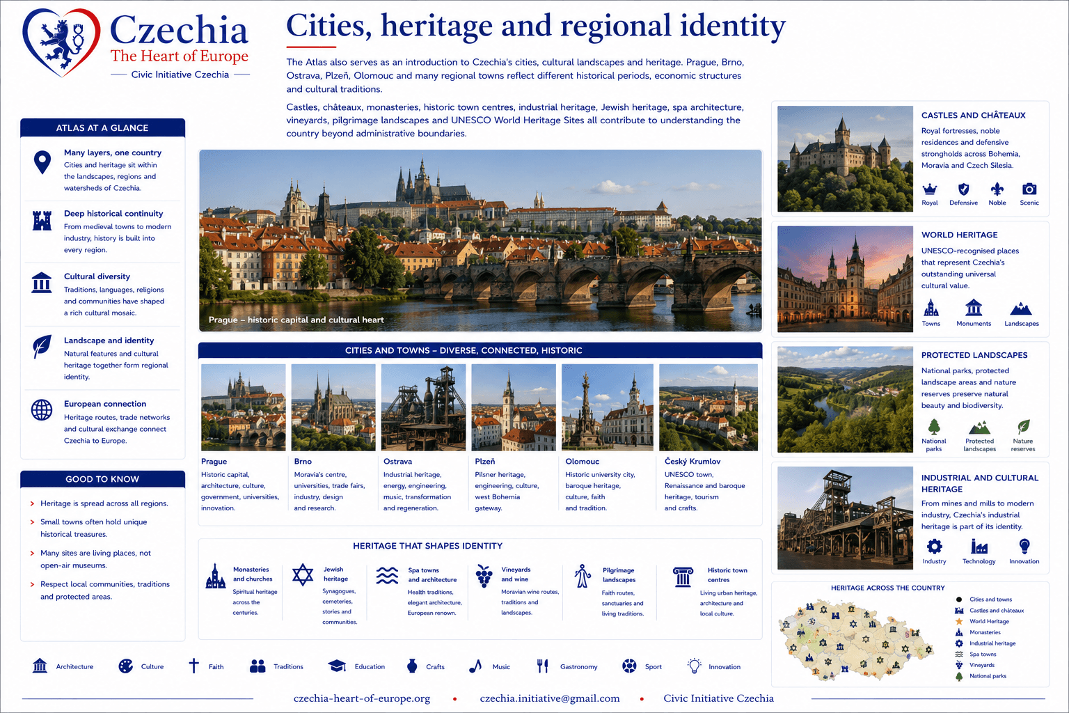
The Atlas also serves as an introduction to Czechia's cities, cultural landscapes and heritage. Prague, Brno, Ostrava, Plzeň, Olomouc and many regional towns reflect different historical periods, economic structures and cultural traditions.
Castles, châteaux, monasteries, historic town centres, industrial heritage, Jewish heritage, spa architecture, vineyards, pilgrimage landscapes and UNESCO World Heritage Sites all contribute to understanding the country beyond administrative boundaries.
Cities and townsHistoric capitals, industrial centres, university cities and regional communities.
Castles and châteauxRoyal, noble and defensive architecture across all historical lands.
World HeritageUNESCO-recognised places representing Czechia's cultural contribution.
Protected landscapesNational parks, protected landscape areas and nature reserves.