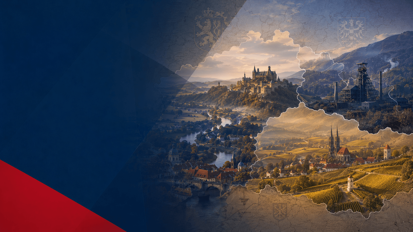
Historical lands of Czechia hero image

About Czechia · Historical lands

Historical Lands of Czechia

Bohemia, Moravia and Czech Silesia explain Czechia through older territorial memory, heraldry, cultural vocabulary, landscapes, regional identity and the public language of state symbols.

BohemiaPrague, Vltava, Elbe, lion
MoraviaBrno, Olomouc, Morava, eagle
Czech SilesiaOstrava, frontier, Silesian eagle
Heraldryvisible in the greater coat of arms

Three lands, one country

The historical lands are the deep map behind modern Czechia.

Czechia is a modern state with contemporary regions, institutions and public administration. Beneath that modern layer is an older historical structure: Bohemia, Moravia and Czech Silesia. These lands explain why the greater coat of arms is quartered, why regional identities remain strong, why place names carry layered meanings and why Czechia cannot be reduced to Prague or to Bohemia alone.
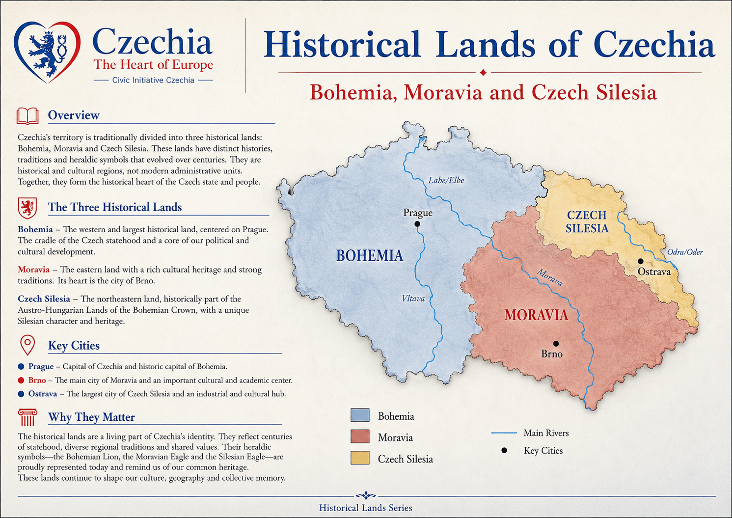
Map reading

Bohemia, Moravia and Czech Silesia are historical lands, not current regions.

The historical lands help visitors read Czechia in a way that administrative borders alone cannot. They connect geography with memory, symbols, settlement, culture and older political history. The modern regional system is useful for administration; the historical lands are essential for identity.

Historical landsLong-term territorial and cultural identities.
Modern regionsContemporary administrative structure of the state.
Public identityThe two layers belong together, but they are not the same.
historical lands map of Czechia

The three historical lands

Each land carries a different spatial and cultural logic.

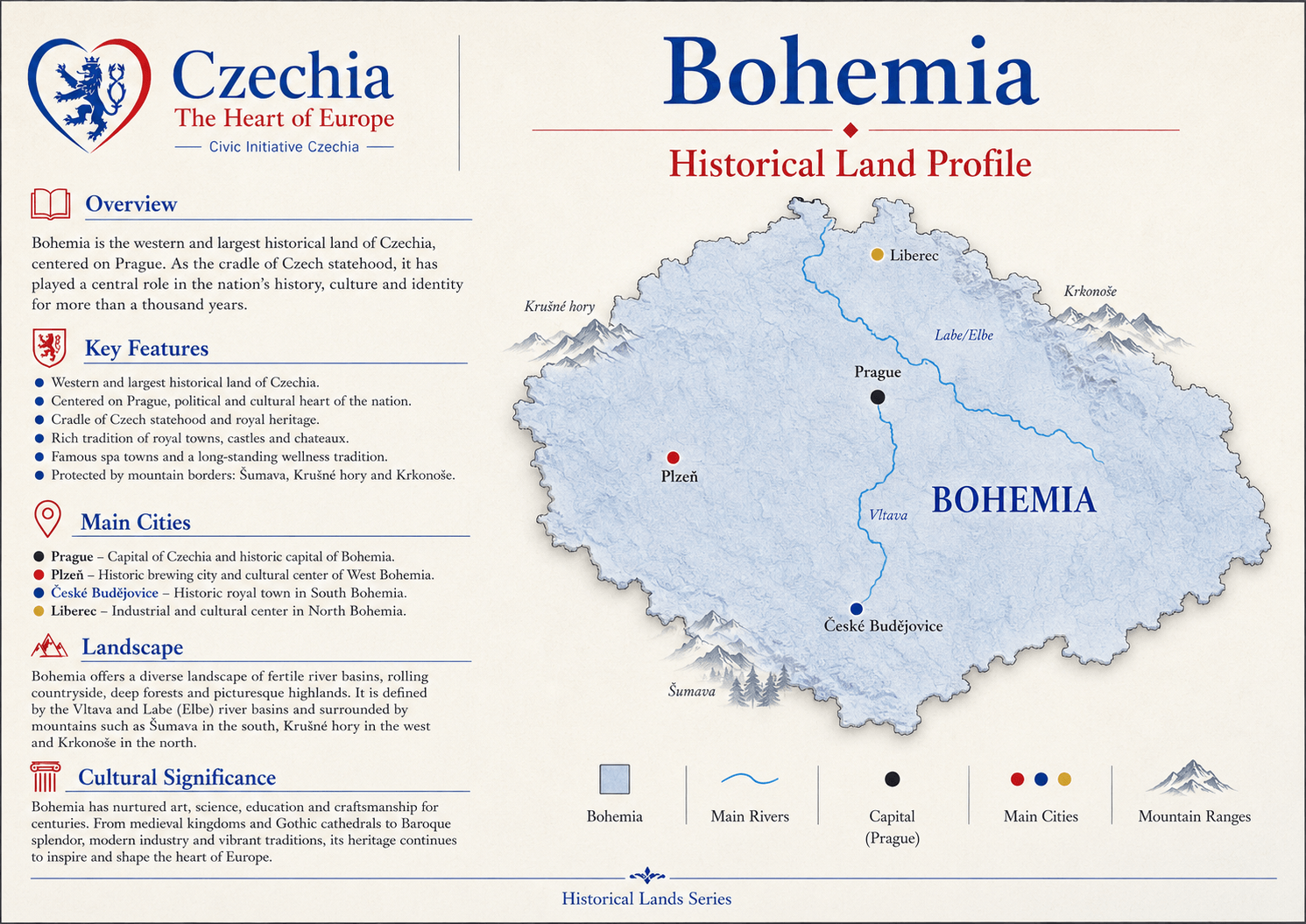
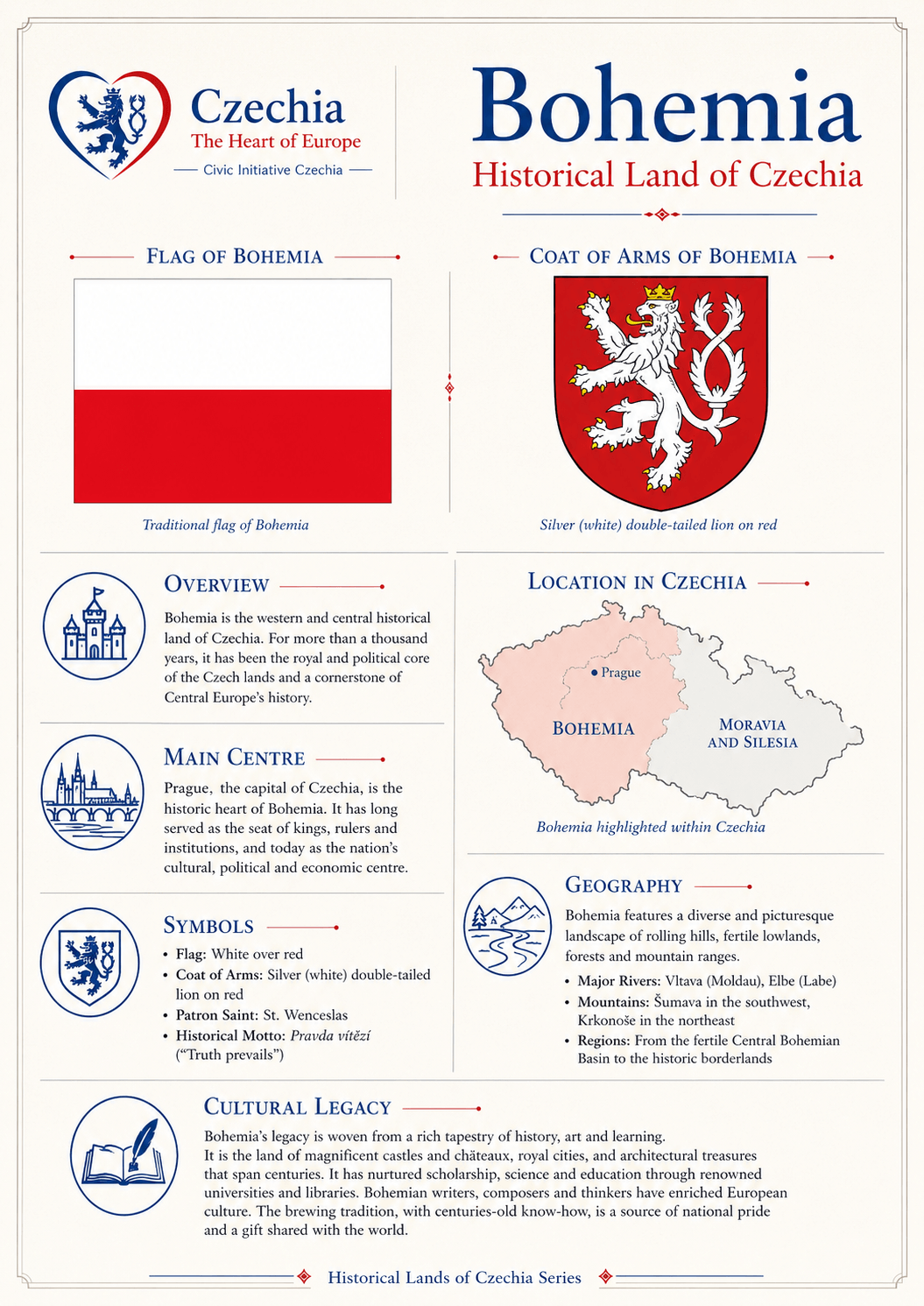
Bohemia Basin, capital and lion Bohemia forms the western and central historical land. It includes Prague, the Vltava and Elbe systems, border mountains, spa regions, royal towns, castles, industry and the silver double-tailed lion that became the strongest Czech heraldic sign.
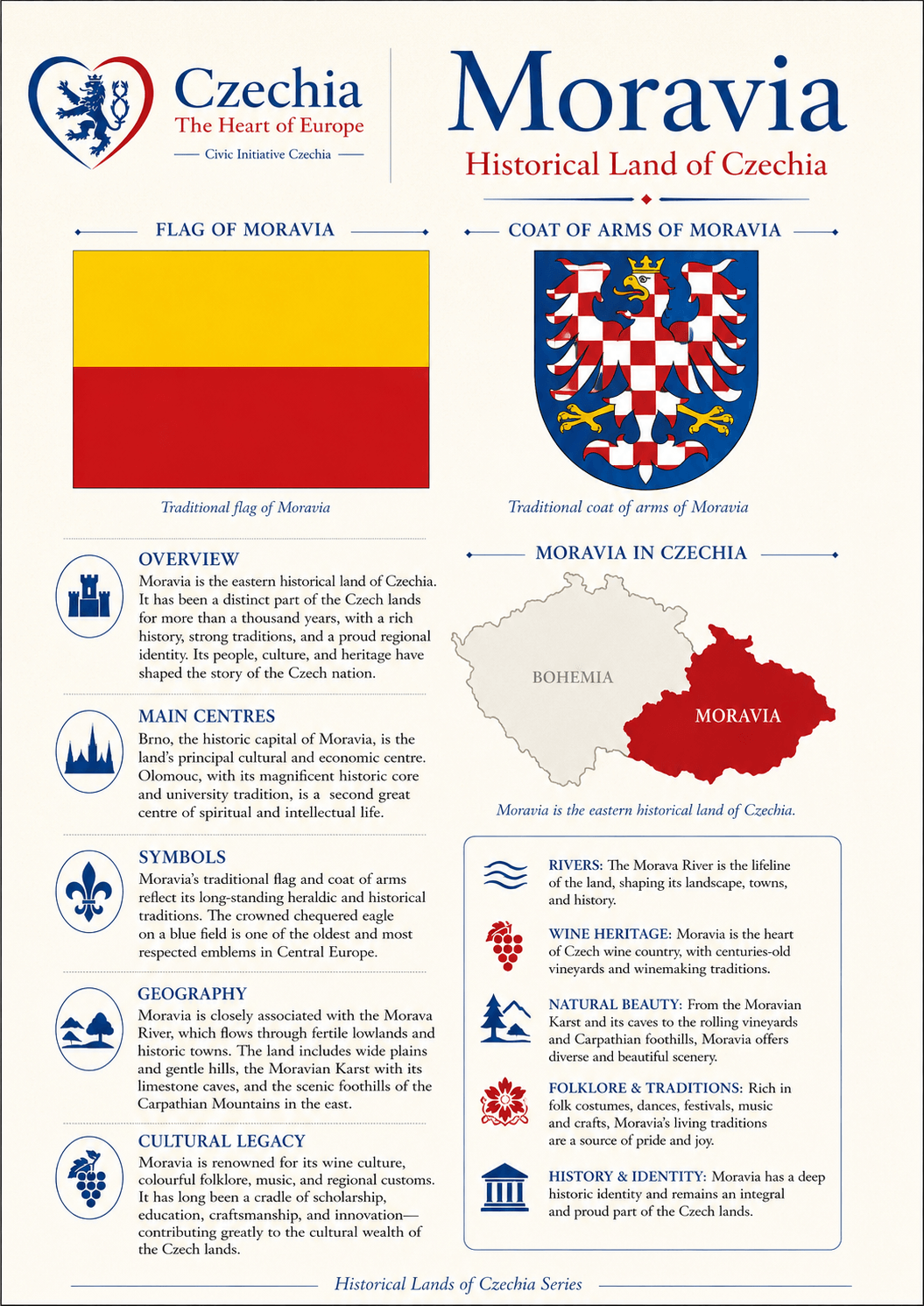
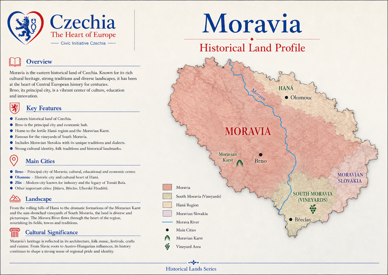
Moravia River, corridor and eagle Moravia forms the eastern historical land. It is structured by the Morava River, Brno, Olomouc, fertile lowlands, uplands, wine country, the Moravian Karst and cultural routes toward Austria, Slovakia and the Danube space.
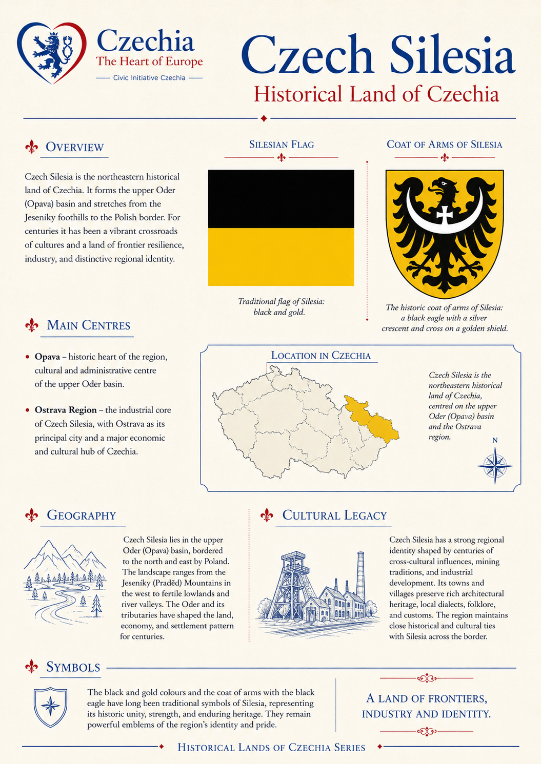
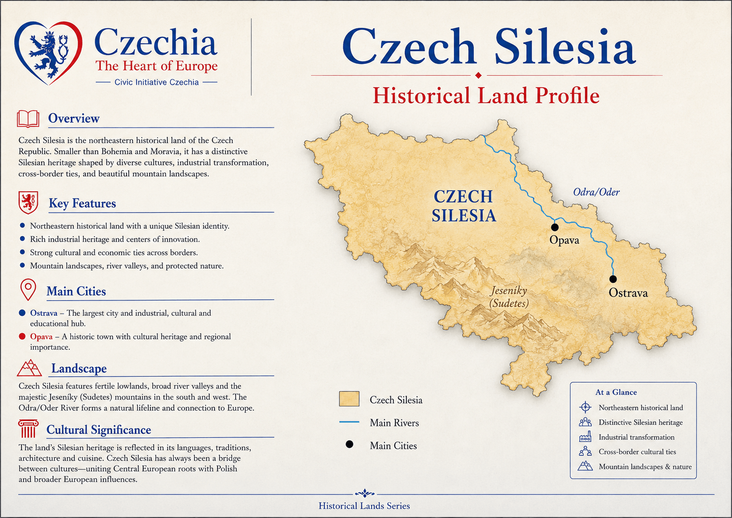
Czech Silesia Frontier, industry and eagle Czech Silesia forms the northeastern historical land. It is smaller in area but essential for understanding Ostrava, Czech-Polish contact, border memory, industrial transformation and the Silesian eagle in the greater coat of arms.

Bohemia

Bohemia is the basin where Prague, the Vltava and the lion meet.

Bohemia is often the most internationally visible historical land because Prague lies within it. Yet Bohemia is not just the capital. It includes river corridors, border mountains, spa towns, castles, royal towns, industrial valleys, forests and cultural landscapes that helped shape the image of the Czech lands for centuries.

Main urban referencePrague, capital of Czechia and historic centre of Bohemia.
River logicVltava and Elbe systems structure the Bohemian basin.
Heraldic signThe silver double-tailed lion on a red field.

Moravia

Moravia opens Czechia toward the Danube and the southeast.

Moravia is not an appendix to Bohemia. It has its own historical and cultural identity, its own major cities, its own river logic and its own ceremonial presence in the state symbols. Brno and Olomouc, South Moravian wine country, Haná, Wallachia, Slovácko and the Moravian Karst all belong to the Moravian reading of Czechia.

Main urban referencesBrno and Olomouc.
River logicMorava River, Danube-facing corridors and warmer lowlands.
Heraldic signThe chequered Moravian eagle on a blue field.

Czech Silesia

Czech Silesia gives the country its northeastern frontier layer.

Czech Silesia is smaller than Bohemia and Moravia, but it is not marginal. It matters for the Ostrava region, Czech-Polish contact, border identity, industrial history, mining memory, transformation and the northeastern orientation of Czechia.

Main urban referenceOstrava and the wider northeastern industrial region.
Border logicContact with Poland and the wider Silesian historical space.
Heraldic signThe Silesian eagle on a golden field.

Heraldry

The greater coat of arms preserves the three-land structure.

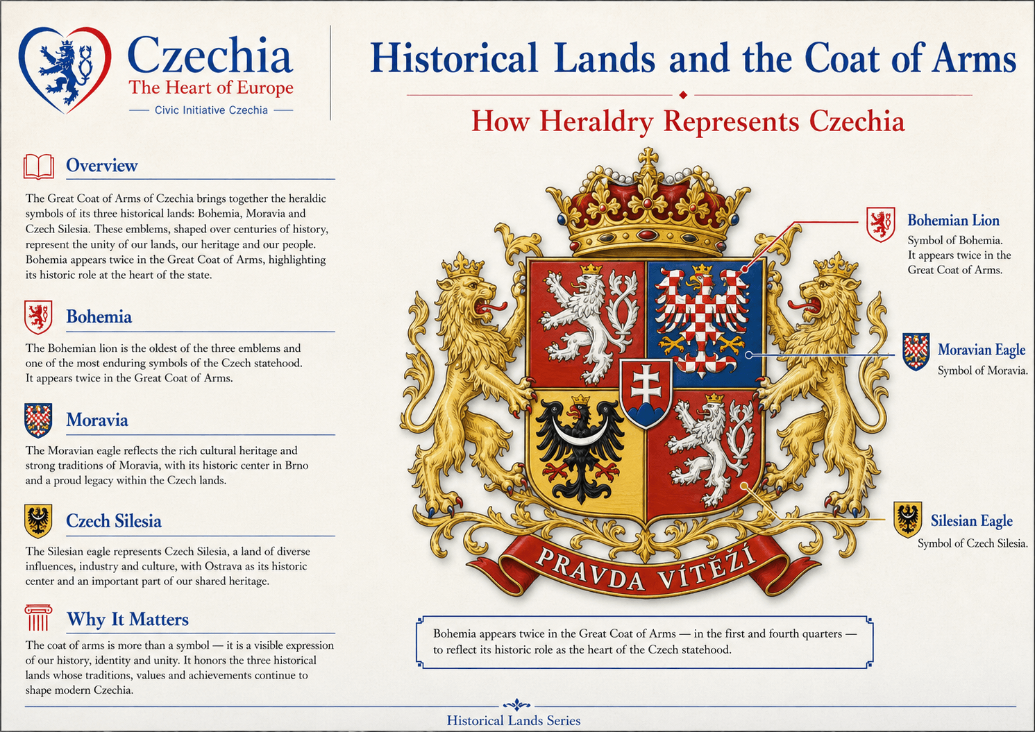
The greater coat of arms is not only a decorative emblem. It is a heraldic statement: Bohemia, Moravia and Silesia are all present in the official symbolic language of the state. The Bohemian lion appears twice, while the Moravian and Silesian eagles complete the historical-land composition.

BohemiaFirst and fourth fields: silver double-tailed lion.
MoraviaSecond field: silver-red chequered eagle.
SilesiaThird field: black eagle.
historical lands and the coat of arms

Historical lands vs modern regions

Historical lands explain heritage; modern regions organise administration.

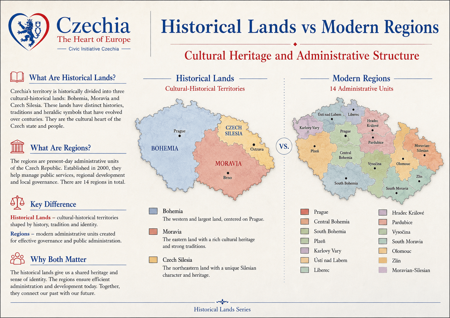
Bohemia, Moravia and Czech Silesia are cultural-historical lands. The fourteen modern regions are administrative units. Both systems are useful, but they answer different questions: historical lands explain identity and memory, while modern regions organise public administration, development and services.

Historical landsOlder cultural-historical territories shaped by memory, symbols and traditions.
Modern regionsContemporary administrative units used for governance and regional development.
Country literacyBoth layers are needed to understand Czechia accurately.
historical lands versus modern regions

Rivers and basins

Waterways shape the historical lands.

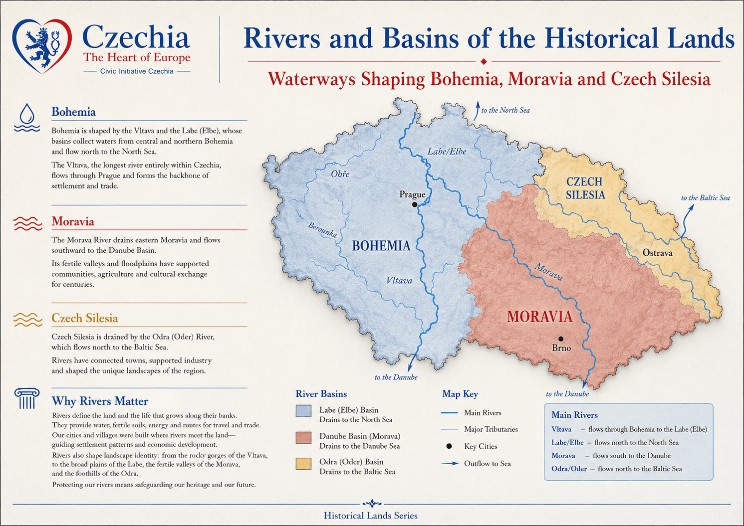
The Vltava and Elbe structure much of Bohemia. The Morava River gives Moravia its name, direction and Danube-facing corridor. The Odra/Oder system connects Czech Silesia with the northeast and the Baltic basin. Rivers shaped settlement, trade, farming, industry, towns and cultural exchange.

BohemiaVltava and Labe/Elbe basin, flowing toward the North Sea.
MoraviaMorava River and Danube basin, flowing toward the Black Sea.
Czech SilesiaOdra/Oder basin, flowing toward the Baltic Sea.
rivers and basins of the historical lands

Natural frontiers

Mountains frame the historical lands and protect regional identities.

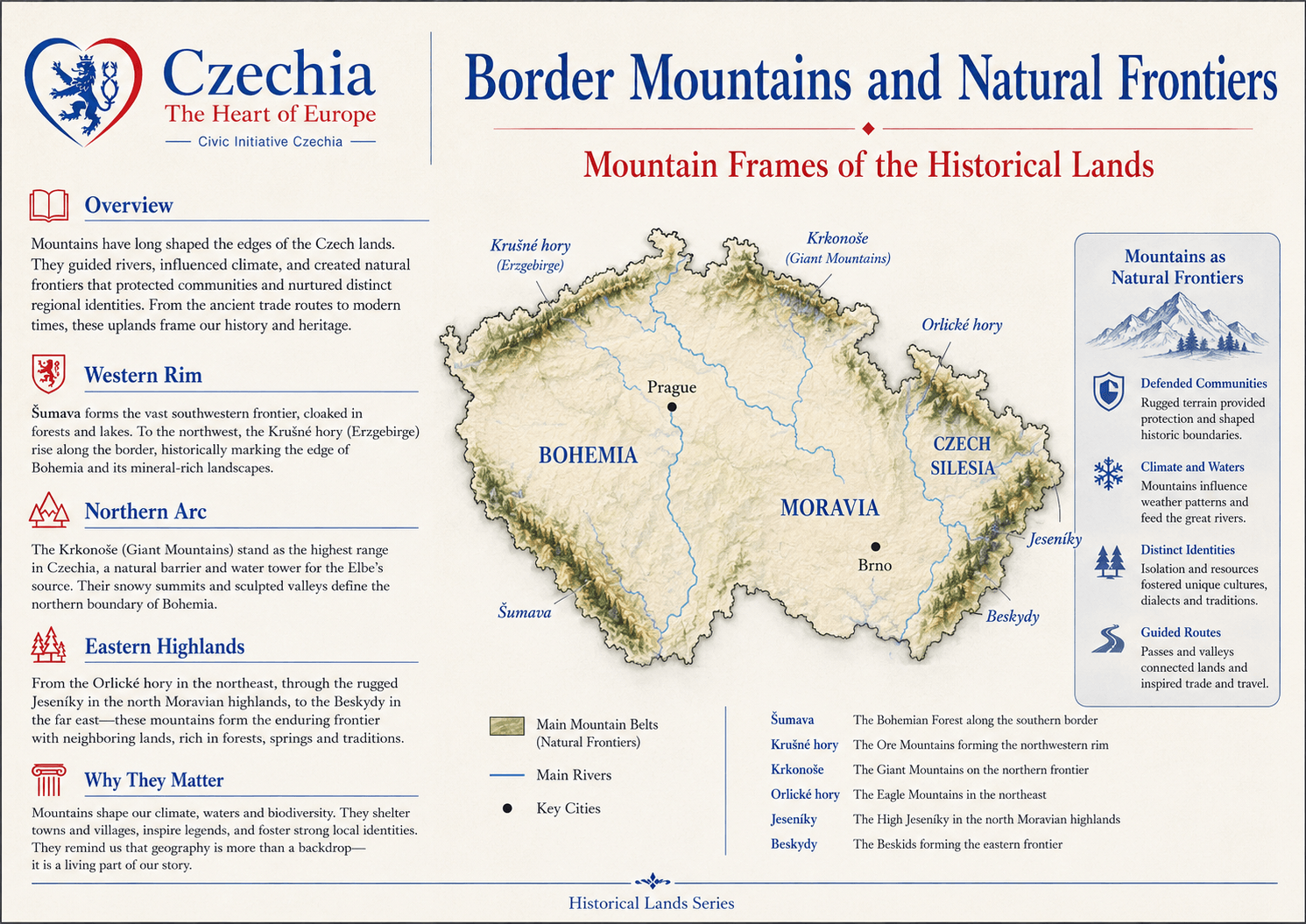
Mountains have long shaped the edges of the Czech lands. They guided rivers, influenced climate, formed natural frontiers, protected communities and preserved regional identities. From Šumava and Krušné hory to the Krkonoše, Jeseníky and Beskydy, Czechia’s mountain rims are part of its historical geography.

Western and southern rimsŠumava and Krušné hory shape Bohemia’s borders and landscape memory.
Northern arcKrkonoše and related mountain systems define highland identity and watersheds.
Eastern highlandsJeseníky and Beskydy frame Moravia and Czech Silesia.
border mountains and natural frontiers

Capitals and cities

Urban centres show how each historical land entered public life.

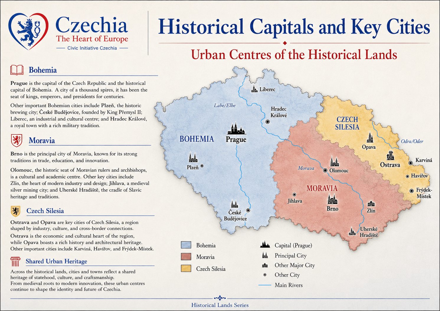
Prague is the historic capital of Bohemia and the capital of Czechia. Brno and Olomouc are essential to the Moravian reading of the country. Ostrava and Opava are key for Czech Silesia. Other regional centres show that Czechia’s historical lands are not abstract labels, but lived urban networks.

BohemiaPrague, Plzeň, České Budějovice, Liberec, Hradec Králové.
MoraviaBrno, Olomouc, Zlín, Jihlava, Uherské Hradiště.
Czech SilesiaOstrava, Opava, Karviná, Havířov, Frýdek-Místek.
historical capitals and key cities

Living traditions

Cultural regions keep the historical lands alive.

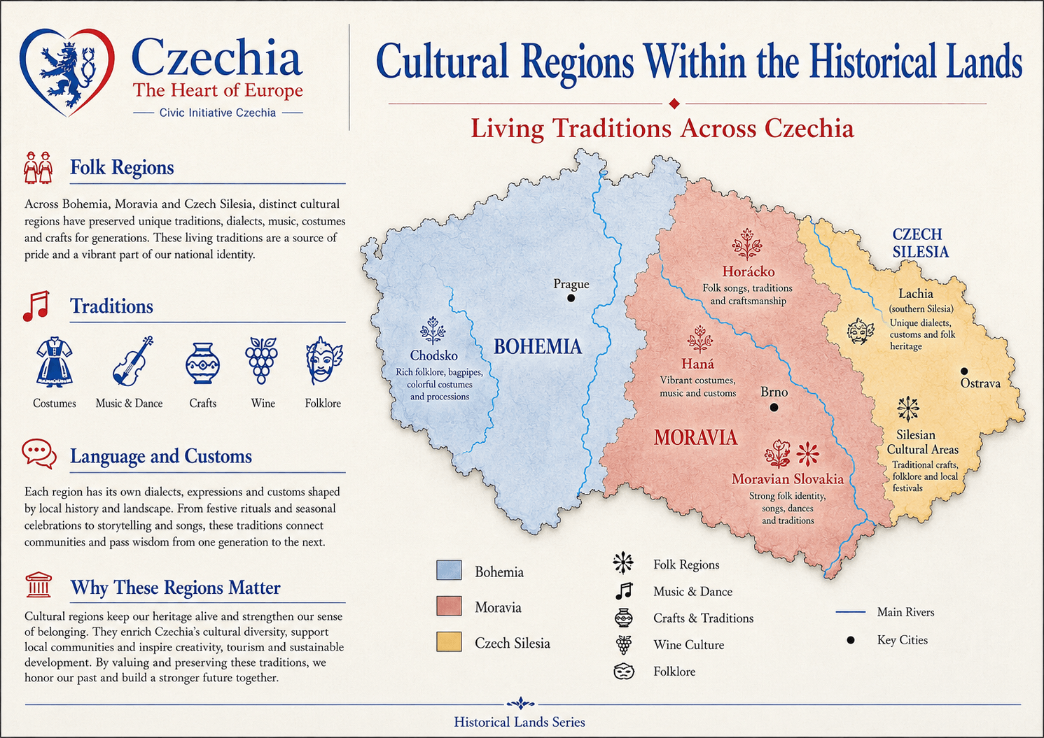
Historical lands are not only lines on a map. They contain living cultural regions with dialects, costumes, music, crafts, festivals, foodways, wine traditions and local memory. Chodsko, Haná, Horácko, Moravian Slovakia, Lachia and Silesian cultural areas all show how regional identity remains visible in everyday culture.

TraditionsCostumes, music, dance, crafts, wine culture and folklore.
Language and customsRegional expressions, dialects, rituals and seasonal practices.
Public valueTraditions support local pride, tourism, education and intergenerational memory.
cultural regions within the historical lands

Modern use

When to use the historical-land names

The historical-land names are useful when explaining geography, symbols, regional identity, culture, heritage, tourism, public memory and the deeper identity of Czechia. They should not be confused with the fourteen modern regions used for administration.

Use Bohemia When referring to the western and central historical land. Useful for Prague, the Vltava and Elbe systems, spa towns, castles, historic towns and the Bohemian lion.
Use Moravia When referring to the eastern historical land. Useful for Brno, Olomouc, South Moravian wine country, the Morava River, Moravian Karst and Moravian cultural identity.
Use Czech Silesia When referring to the northeastern historical land. Useful for Ostrava, Czech-Polish border context, industrial heritage and Silesian identity inside Czechia.

Timeline

The historical lands connect old statehood with modern Czechia.

  1. Medieval periodBohemia, Moravia and Silesia develop as historical lands with distinct territorial, dynastic and heraldic meanings inside Central Europe.
  2. Crown landsThe lands associated with the Bohemian Crown become a major historical framework for Czech statehood and later public memory.
  3. 1918The Czech lands become part of Czechoslovakia after the First World War, together with Slovakia.
  4. 1993The independent Czech state is created. The historical lands remain part of public identity, geography, heraldry and regional vocabulary.
  5. TodayBohemia, Moravia and Czech Silesia help explain Czechia beyond administrative borders and beyond Prague alone.